
We had been on the water for three days and three nights by the time we reached Long Point; our 40 foot Adams-designed, Bluewater Cruising Yachts Polaris II was handling the conditions well. But, even with reliable forecasting the weather had occasionally thrown us a few surprises.
Our three-person crew: skipper Rocket Robertson, his wife Margaret and me as their faithful sidekick, had worked well in the changeable conditions. As we prepared to leave the modest protection of Long Point north of Bicheno, however, we were about to encounter some more.
Trouble off Freycinet
The anchor held fast and we departed Long Point after a surprisingly restful night, heading south towards Freycinet Peninsula. For no particular reason other than he had visited France not long before, the skipper set a tri-colour flag. The French had explored this coastline two hundred years before us and named many of Tasmania’s bays, islands and headlands, so arguably it was appropriate.
The sky was blue and a steady 15 knot nor’easter pushed us past the town of Bicheno and on towards one of Tasmania’s iconic national parks. The day was warming up, the moderate breeze was steady from the north, it was great to be on the water. It was all about to change.
First the wind started to ease leaving a sloppy sea state, then it changed direction. We tried to set the Screecher, but soon afterwards all hell broke loose!
The breeze swung wildly and increased dramatically from the southwest. We started to haul down that cursed sail and quickly the wind ramped up to 27kn. Panic on deck!
I fluffed the halyard drop and we almost lost the damned Screecher overboard, not a bad option in hindsight. We scrambled to get it back in its bag and soon afterwards the wind began fading again. By now we were in a headwind, passing by Wineglass Bay entrance. After that bit of excitement I decided to go below for a much-needed sabbatical.
An indeterminate amount of time later I poked my head up and things had changed, but not for the better.
We were ploughing into a headwind, abeam of a narrow channel between the southern tip of Freycinet Peninsula and its companion piece Schouten Island. The seas were ugly and, though the wind was not gale force, it had picked up to be well over 20kn. It was all against us. I soon noticed another thing. We seemed to be getting backwash from the massive and forbidding granite cliffs which lined the ocean side of Schouten. We were the bobbing olive in an ugly ocean cocktail, with spray regularly breaking over the bow. As well, either the current or the tide or maybe both was almost pushing us backwards, even though we had the motor running. It was uncomfortable, unpleasant and plain hard work.
The presence of the huge ugly granite walls a mile or so away to our lee was a reminder of our fragile location. Margaret asked the question about whether we should turn tail and head for that inviting channel down to leeward, but our skipper was stoic. We would press on, hammering to windward against the forces of nature. We slowly crept past more jagged outcrops which resembled the jagged teeth of a snarling mongrel dog.
We had a nerve-jangling hour or so of tense, stressful windward work. hen gradually, painfully slowly, we eased away frovm the threatening monoliths to leeward. The waters smoothed out ever so slightly and off in the distance further south, we eventually spied the shadow of a peak, the northern end of Maria Island.
Somewhere in the middle large pods of dolphins telepathically contacted their mates: “hey, there’s bow-wave action north of Maria. Get in there and pick up Polaris II!” They sliced towards us like torpedoes and, at the end, we had a row of six or seven playing with the boat as we made steady progress towards our next port of call. It made all the messiness and stress from earlier just melt away.
As the afternoon light began to fade, as the dolphins guided us in, the lows of cruising became the counterweight which made the highs seem that much better.
Maria Island
We cruised down the flat waters between the Tasmanian mainland and Maria Island, known as Mercury Passage after the HMS Mercury which English explorer John Cox used to investigate the region in 1789.
The island in some respects is a mirror of larger Bruny Island to the south of Hobart. Roughly shaped like an hour glass, 20 kilometres long and about 13 kilometres wide, its northern end is large and bulbous, while its smaller southern end is shaped a bit like a blunt boomerang.
Like Bruny, the two sections are joined in the middle by a narrow isthmus, which at its narrowest point can be easily crossed on foot in a minute or two. Though it is now a national park and various forms of industry and farming had been attempted on it at different times, its earliest European habitation was as a place for recidivist convicts, the worst went to the dreaded Macquarie Harbour on the state’s remote west coast.
The two wide curving bays either side of the isthmus offered good anchorages in the right weather, so we aimed for the western arc known as Chinaman’s Bay, which was south of LeSueur Point. Late in the day we motored into the shallow bay, anchoring around 200 metres off the beach. The wind had swung to the west, but we still had reasonable cover.
Early sealers who worked the waters from 1805 and later, whalers, clashed with the local aborigines. From 1825, five years before Port Arthur was established, a penal settlement was built at Darlington on the north-west shore of Maria Island.
Food was short and the men had to scavenge for local wildlife and fish; not surprisingly many became ill. Their labour included chopping down trees and clearing ground in attempts to grow crops. Stone buildings were constructed and several still stand, some being used for national park administration and basic accommodation.
Various industries were tried to get the colony to pay its way, but the location lent itself to easy escapes and after Port Arthur was set up in 1830, the first version of Maria Island’s convict settlement closed in 1832.
But the settlement was revived in 1842 using the so-called ‘probation’ system, where convicts were withdrawn from private work and re-organised in government prisons.
Probation stations were set up at Darlington and LeSueur, near Chinaman’s Bay. Both finally closed in 1850 and from there farming, wine and fruit growing and even a cement works using the island’s limestone deposits were all tried at different times. At one stage Darlington had a population of around 500 people. But financial problems and the Great Depression combined to close its cement plant in 1930.
After that sheep and cattle were tried and Chinese abalone fishermen at one stage worked out of the bay that took their name. In the sixties a reserve was set up for local fauna and in 1971 the island became a national park.
On LeSueur Point you can find some ruins of its penal settlement, though basically not much more than one low, narrow crumbling red brick wall with a few cells along it. We rowed ashore and walked across the peninsula amongst dried-out eucalypts to take a look. We discovered plenty of wildlife including: kangaroos, Cape Barren Geese and wombats. In fact, it transpired there were so many wombats they had overpopulated the small peninsula and a large number were sick. Apparently the park service was looking into it.
Our short landfall had given us a taste for more, but we were moving on. We had been on the water for five days now and we were still well short of our destination of Hobart. Ahead lay the challenge of sailing around the famed Tasman Peninsula, which had been a background for countless Sydney to Hobart race pictures, usually taken from helicopters or aircraft to emphasise the dramatic nature of its massive and forbidding volcanic black rock columns.
Tasman Peninsula
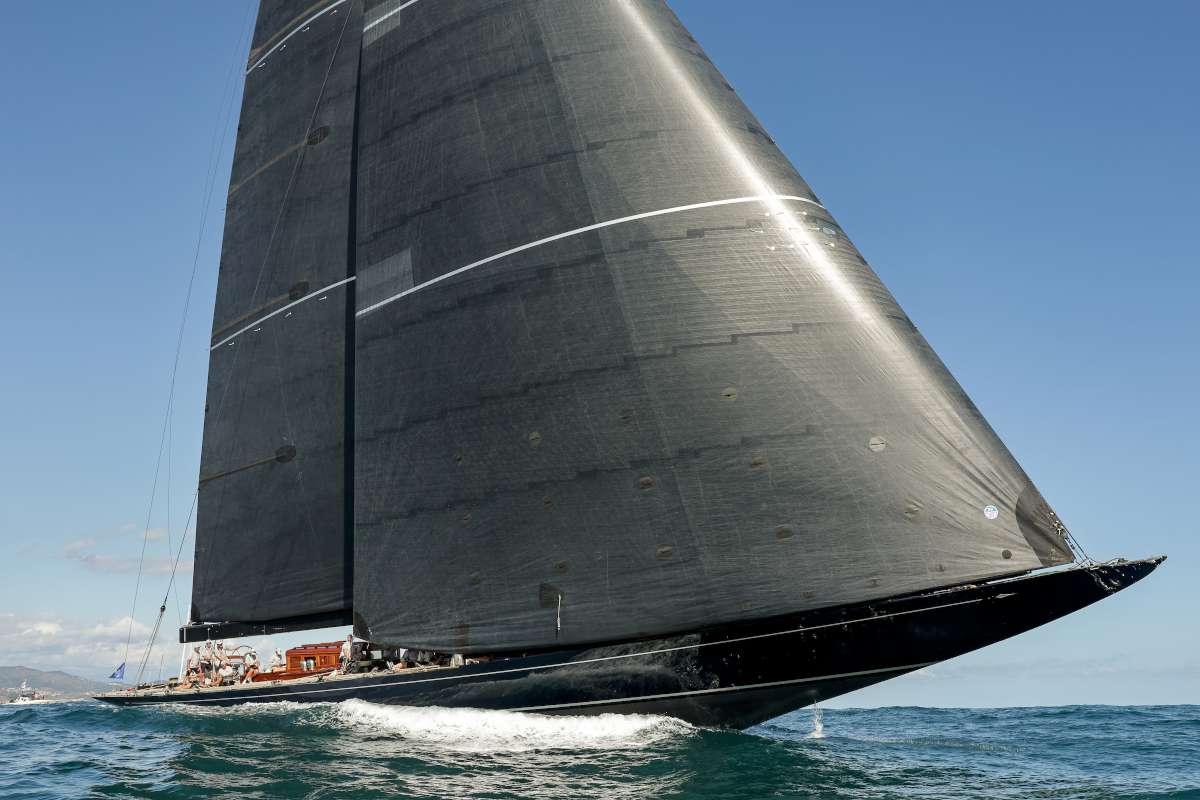
As we crossed the waters from the bottom of Maria Island to the top of the Tasman Peninsula, the conditions once again lent themselves to the skipper’s favourite bit of inventory: the Screecher!
We hauled it up and, for the longest time on our whole voyage, it stayed set. It must have lasted all of 20 minutes before the breeze began to pipe in and push us off course.
Finally the inevitable order came: “drop the Screecher!” All the practice with that manoeuvre was by now paying dividends and the procedure went as smoothly as it had for the whole journey.
As we sailed clear of the lee of Maria, the waves began building and we moved steadily into Marion Bay, then along the dark jagged cliffs of the northern Tasman Peninsula.
We eased down the coast and past the wide arc of Pirates Bay, behind which was located the famous Eaglehawk Neck. Penal authorities had used the narrow land ‘neck’ as a barrier to keep convicts on the peninsula, correctly assuming most of them could not swim.
We passed yet more black and threatening cliffs and outcrops crossing Fortescue Bay entrance, which we later discovered hid a couple of very fine anchorages. then finally approached some truly dramatic natural features, the three jagged outcrops at the tip of Cape Hauy, with narrow channels between them.
In the dull grey weather they looked ominous and threatening. From there the winds and currents became less predictable. We were approaching the very end of the peninsula at Cape Pillar and Cathedral Rock, along with its giant grey offshore edifice: Tasman Island, which stood out for its massive vertical columns of dolerite cliffs.
We stayed off a safe distance allowing for the winds which switched and gusted through the gap, but even in moderate airs this corner created an unsettling mix of odd currents and eddies with unusual waves and chop. We kept the motor going just in case, though we noted a couple of locals: a fishing boat and yacht, seemed to have no worries about going in much closer.
As we turned the corner, a slow process given the shifty conditions and confused sea state, the sun began to break through. Slowly the breeze steadied and we reached along another rocky shoreline towards Port Arthur. Late in the day we motored into Carnarvon Bay, where we saw the remains of Australia’s best-known convict penal settlement.
Port Arthur
I had not been to Port Arthur for many years, even then it had been in a car. It would have been punishment enough to arrive at this remote territory on the other side of the world, but soon enough that would have become the least of the convict’s worries.
Port Arthur, which started as a timber-cutting settlement for prisoners in 1830 but by 1833 became a site for recidivist prisoners, garnered a well-earned reputation as a lonely hell on earth. The men serving time there mostly regretted ever seeing the place.
It was founded on the then novel idea that punishment along with education and training might offer these people a path to redemption. So work was a key component at Port Arthur. Prisoners learned a variety of trades.
A few were industrious enough to work out how to escape, but they rarely lasted long. The Tasman Peninsula was well chosen as a wild and unforgiving environment which made convicts pay for their indiscretions. If the guards did not get you, the foreign ‘bush’ did.
Children and women did time here as well. Whether they were mining coal, or sitting alone in the separate prison, spending time at Port Arthur offered a particularly unpleasant way to pass the years until transportation ended in 1853. The facility finally closed in 1877.
Not so much now of course. The last time I had been in Port Arthur it was a relatively modest national park setting. But things had changed. As we rose in the morning I looked out into the bay and saw a massive 300 metre cruise ship, disgorging the first of its many passengers for a day at a Disneyland of crime and punishment.
We rowed ashore to the old Commandant’s jetty and were promptly told to move off by a local attendant. Fearing our own incarceration, we paddled across the small harbour and tied up as yet another ferry was offloading some of its 2,600 Poms, Germans and yes, Australians from the Diamond Princess. Port Arthur had become a cruise ship destination! What would those poor wretches, arriving here 160 years before in their dank and squalid wooden ships, have thought about that?
We wandered onto the site and were advised to drop into the visitor’s centre to pay our national parks fee of $39 per person. It was so new the fancy eatery inside was still being finished, but no worries, there was a coffee van in the grounds and a café in amongst the restored ruins.
We explored with our fellow travellers for a while, watching the informative video screens and following the background boards, then made our way to our own transport. On the way back to the jetty we passed a tall, dense, well-maintained hedge. Inside, amongst a quiet memorial garden, was the gutted stone shell of the Broad Arrow café, where 20 of the 35 people shot in Australia’s worst mass killing had been gunned down, with a plaque remembering all the victim’s names.
Across Storm Bay
The skipper was keen to get going. The holding tank aboard Polaris II had cracked and below decks a pungent odour could occasionally be sensed around the washroom. We needed to make a landfall to secure technical support or things might get messy.
Around lunchtime, as we hauled anchor and made our way past the Isle of the Dead where unfortunate convicts were buried, the light prevailing airs were rapidly replaced by a punchy southerly which was working its way down the bay. We found ourselves motoring and tacking into a headwind and, as we cleared the entrance to the Port Arthur inlet, the waves built up quickly hammering us with heavy spray. As we had come to expect, the wave pattern became uneven and it made for hard work.
We tacked, but we had to clear Cape Raoul by sailing hard on the wind. Still, it was exhilarating and Polaris II rode the rough seas well. Once we cleared the Cape we were able to free off a bit and begin reaching across Storm Bay towards the mouth of the Derwent River.
The hard breeze dropped imperceptibly as we changed direction and, late in the afternoon as we passed another famous icon, the Iron Pot marker which indicated the mouth of the Derwent, we were rolling nicely along with the headsail poled out and a steady 15kn breeze behind us.
The sun was lowering in the western sky and the living was easy.
Final port of call
Up river, the breeze gradually faded. We gybed and followed the line of the river taking in the outer suburbs of Hobart on both sides of the Derwent.
The skipper had been making calls and decided we would head into Royal Yacht Club of Tasmania to refuel. It was one of the bigger marinas in the city and it was positioned not far from the Wrest Point casino. We were not planning on gambling, but the tallest tower in Hobart was a useful landmark.
As we motored towards the marina we noticed that our cruise ship from Port Arthur had chased us and though it had left well after us, had caught us up. Hobart is now apparently one port of call in a circuit that includes Melbourne and Sydney as well as Port Arthur. At least two big cruise ships can lay up at Hobart’s dock and they visit regularly.
For us, stopping for refuelling proved fortuitous. The locals at RYCT were very welcoming and as well as signing us in to the club (no meals unfortunately, seeing as how it was a Saturday night), we were offered a berth at the fuel dock overnight. Grateful for the help, we wandered up to Sandy Bay’s main street and found an open restaurant, where we celebrated our arrival.
Our trip had faced its challenges, but we had pulled through: boat, relationships and stomach more or less intact!
The next morning in a light breeze we continued upriver, passed under the Tasman Bridge and took a brief time out to photograph the Polaris II under sail. Naturally the skipper grabbed the chance to set his favourite canvas: the Screecher. Would you believe it, that damned hybrid perfectly behaved itself. Must have been the camera!
We found our final port of call at the marina in Prince of Wales Bay, just past the massive heavy industrial site which was Nyrstar’s zinc smelter. Across the river was a patch of untouched bushland: quite the contrast.
Prince of Wales Bay was the site of shipyards and services, so it was the right spot to fix the suspect holding tank. On our last night in Hobart we took an Uber into town to visit Constitution Dock and got fish and chips at Mures famous eatery.
The dock precinct had changed a lot since my last visit. It had definitely gone upmarket with several fancy restaurants, bars and apartments. The local chandlery was up for sale and it was clear this part of Hobart was well on the pathway to getting gentrified.
As we left the city to head back to Prince of Wales Bay for a final check of the Polaris II, another huge cruise ship was just tying up at a nearby berth. Mures would soon have more customers than it knew what to do with. ≈


