
Esperance Western Australia is just one of those wonderful places that is rarely visited and then only by boats travelling east or west across the Great Australian Bight.
It is not to be missed. There is a friendly and welcoming yacht club and everything that one would ever want is available in the township.
Best of all are the pristine cruising grounds of the Recerche Archipelago, a cluster of one thousand islands and rocks in a 200 mile stretch of what is largely unsurveyed waters off the southwest coast of WA.
I had left my Waller 880 catamaran on a mooring in Esperance Bay for the summer, while family, work and yacht club commitments back home took precedence. Returning after Easter I found Slinky Malinky sitting quietly awaiting the next stage of my part time, fly in fly out, cruise around Australia, keeping the big island on the left.
On the seawall in front of the Esperance Bay Yacht Club, with my brother David and an old school mate Rob, we would reside for a few days while some repairs effected, reprovisioning completed and the standing rigging replaced.
It was a no brainer. The rig was 14 years old and I did not want to concern myself with a possible rig failure in the Great Australian Bight so we just did it. I am glad we did.
All passage planning research for a comfortable crossing of the GAB dictated that for an eastbound ride the best time was
in autumn when the prolific easterlies and the normal passing cold fronts lost some of its potency and lows are not as deep as those of winter.
We departed Esperance with steady north easterly winds which, once we cleared Cape Le Grand, headed us for a solid beat up the coast to the favoured anchorages of Lucky Bay, Hammerhead and Duke of Orleans.
Recerche is certainly not a place to sail through at night and we were soon reminded just how good it was to have a sea running so we could see the hazards to navigation.
The offshore winds ensured that the nights were comfortable at anchor. The fishing was good as were the walks ashore. At every anchorage we would climb the nearest hill with our phones and laptop in anticipation of a connection and thus the weather forecast.
Cape Arid, 90 miles east of Esperance, is a pretty desolate place so aptly named by Flinders. But our spot in a little bay for the night was delightful. Next morning we motorsailed over to Middle Island, our planned departure point for the passage across the GAB. We circumnavigated the island exploring little coves as the weather was benign and the fishing good.
My plan for the GAB had always been to leave on the back of a front. One was coming and it promised to be all we wanted, perhaps more than we wanted but here in the Southern Ocean you have to take what you are given. Or do not go at all.
The isolated Daw Island lies east of Cape Arid and about 45 miles from Middle Island. It is in uncharted waters but a Google map and an old mudmap confirmed an anchorage secure from the SW.
After climbing a hill on Goose Island near Middle Island to get a weather update we elected to make a run for Daw Island. I thought we would get there before the forecast front arrived. We did, almost, after a beautiful kite ride for the first thirty miles in rising winds.
Our entrance into the lee of the two little wave break islands protecting the anchorage was exciting with triple reefed main and a few rolls in the jib. There we lay out 50 metres of chain in a depth of four metres and sat out the blow. We were not going anywhere.
Next morning the glass was low and the wind and seas high. It still looked angry so we waited. I knew my biggest hurdle was to make the decision to go. Once out there we knew it would be boisterous but it was going to ease … eventually.
So we left and settled down to the serious business of an ocean crossing.
I had hoped we would be at sea for four nights and at worse five. After the first twenty four hours we were well on track with a 160 mile day under triple reef and in squally, wet conditions.
The autopilot could not cope so we had to steer. It was tiring and noisy, but it did ease off as forecast and we then really settled into the routine of sleeping, eating and standing a watch, of sorts.
My charts, or lack of, showed a gap from Middle Island to Head of Bight. This was not an issue as I had no intention of stopping anywhere enroute especially as it were to be a lee shore. I did, however, have on board a 1985 edition of the Jacaranda School Atlas and in it a full page spread of southern Australia complete with lines of latitude and longitude. More than enough for our ocean passage.
When the winds softened we motorsailed, if only to ease the slamming and to maintain a reasonable speed. Most of the passage after the first day was on the nose or at best with sheets sprung. Although it was noisy with waves crashing into
the hull and bridgedeck we made good time.
Then about 150 miles out from South Australia our outboard, which had been running like a Swiss watch, made some strange noises. I shut down and decided to have a look in daylight. The sight of emulsified oil suppurating from the dipstick opening was not a pretty sight, nor was the fact that the dawn was heralding an oily calm. There was little else to do but sit and wait and wait and wait.
Occasionally we would be teased with a zephyr for an hour before sitting again for six. Our course from Daw Island had been basically East-090-ish and as we crawled towards the SA coastline the winds backed from the south to the SE and then to the east, so we dutifully followed.
I had onboard a copy of Graham Scarce’s ‘Cruising guide to historic west coast ports’, which I found to be invaluable. Not only was there information about ports, islands and bays but an interesting discourse on the history of the area from exploration to more recent wrecks.
We were not going to make Port Lincoln, but Elliston and the Investigator Group of islands was a possibility; one that was soon dismissed as the winds played games with us as we drifted north.
Streaky Bay started to look promising, especially as it has a secure anchorage for a blow while we sorted the outboard motor. At one stage we were closer to Ceduna than to Streaky Bay but I was reluctant to give up any southing.
The last 60 miles took us 36 hours and that was truly painful, but as we made landfall a five knot southerly allowed us to hoist the kite and tight reach east. This was just so good and memory of our becalmed periods all but forgotten.
The seas got softer and the skies cleared. This champagne sailing was a treat.
We dropped the kite for the final six mile beat up through Blanche Port to the picture-postcard township of Streaky Bay, where we anchored just 100m off the beach in front of the pub. It was a very satisfying moment to reflect that we really had sailed across the GAB in a 28’ catamaran.
A shower, some Coopers Pale Ale and some oysters were on the agenda. Easy fix.
Not so the outboard. If you are going to be stuck somewhere awaiting a new outboard I can think of few finer places than Streaky Bay, a small country town with a big hearted community.
The lads left me to sit it out, which indeed I did when the usual blow went through. Holding was good and with every bit of chain over the side and a second anchor out I was again not going anywhere. Chain in the locker is not worth a cracker when you are on a lee shore.
The new motor arrived from Port Lincoln as did my daughter Rosie and her flatmate Caro for the next leg to Lincoln.
We sailed out of Blanche Port and across the shallow southern shore of Streaky Bay littered with oyster farms to Cape Bauer before springing sheets and heading south to Sceales Bay.
The cliff and sand dune scenery that passed was just stunning as we day sailed down the coast stopping at Heart, Baird and Venus Bays. Heart Bay is an open roadstead anchorage just south of Sceales Bay and although protected from the wind the ever-present swell invaded, making it a less than peaceful night. I did console the girls with the fact that it would have been a whole lot less peaceful if we were in a monohull.
Both Baird and Venus have bars which can be safely crossed with care and with low swell. At neither could you hit bottom, but it does get exciting running in with breakers either side.
Venus Bay was the pick and we enjoyed the comfort of a landlocked anchorage. Internet and mobile access was readily available for a lot of the coast and that gave reassurance in being able to access weather forecasts.
From Venus Bay we had intended to visit Flinders and Pearson Islands of the Investigator Group but the winds would not allow us. Well, I was not keen to punch headwinds into the night when the little township of Elliston on the shores of Waterloo Bay beckoned.
We could get there by dusk and the bar is 350m wide and plenty deep enough given that it was a trading port in the early days. The ketches and schooners plying the Eyre coast would enter under sail. We had a new motor. We also had
a swell of maybe 1.5m. We had leads, but it is also a long run in between the fringing reef. We caught a couple of waves.
This was just a bit exciting but we entered unscathed and soon anchored in a suprisingly calm bay, just a short walk into town and the pub for dinner. Small town country pubs and cafes have so much to offer and we enjoyed our short stay in Elliston.
The bar was benign next day and so we headed to sea anticipating some lively action as we crossed. It was not to be but we were not disappointed. Nor were we with the blue sky day and 12 knot breeze as we sailed with sprung sheets southbound to Coffin Bay.
We were not going to get there before dark but it mattered not as the slowly shoaling Coffin Bay is ten miles wide and five miles deep. We just sailed into four metre depth and dropped the hook. The beach was upwind another mile but we had flat water and plenty of swinging room!
It was a pleasant night even though the forecast building of the southerly wind put up a little chop. The morning greeted us with 30 knot rain squalls so we delayed our departure for the beaconed channel into Port Douglas and to the township of Coffin Bay.
It was going to blow for a couple of days and we planned to explore the waterway and coastline before heading around the corner to Port Lincoln. Besides there were oysters to sample.
With a triple reefed main and a few turns on the headsail we motorsailed in through the entrance and tacked up and around the oyster farms. It was solid but at least the seas were soft and the navigation easy as we stayed in the dark water.
Coffin Bay, a national park, is simply a stunning cruising ground with beaches and sand dunes, wildlife both in and out of water and very few visitors out of season. An anchorage can be found for any prevailing winds and the fishing not too shabby.
The township mooring area is landlocked and the prime real estate is in front of the yacht club. So that is where we parked and went ashore to enjoy all that Coffin Bay had to offer. The oysters were cheap and just sensational.
While the winds blew relentlessly from the south we meandered around the bay walking the dunes and stalking emus, fishing and reflecting how lucky we are in this country to have pristine waterways on which to cruise and explore.
At the northwestern tip of Coffin Bay is Point Sir Isaac and a small bay with a sandy beach called Seasick Bay, so named by Matthew Flinders.
For us on a catamaran, tucked in close to shore and out of the ever-present SW swell, it caused no grief and we slept soundly.
The weather forecast heralded more southerly winds and backing to the east, but softening as the day passed so we left early and motorsailed into the dawn. It was not pleasant and it took hours to cover the first 15 miles to Point Whidbey. But once cleared we were able to sail ten miles in the right direction for every one mile out to sea.
It was a long day as we hauled in the clifftop windfarm and then cleared Cape Carnot before springing sheets for Williams Island, just south of Cape Catastrophe. Eight men of Flinders crew on HMS Investigator were lost at sea searching of this coastline for water. Our night entrance to the small open bay on Williams Island was without drama as we sounded in under the loom of the flashing light on the hill.
The run north to Port Lincoln was a dream run and we congratulated ourselves on having pushed on the previous day so we did not encounter the backing breeze which would have made the passage tiresome. The cruising grounds around Port Lincoln are one of the finest in the country with clear waters, a host of islands and bays at which to anchor for any prevailing or forecast conditions, national parks and great fishing.
Next time I am coming back with a trailable yacht and no time frame, unlike this trip where winter is fast approaching. There is still Bass Strait to transit to complete my circumnavigation of Australia, keeping the big island on the left.
The forecast looks promising for tomorrow!
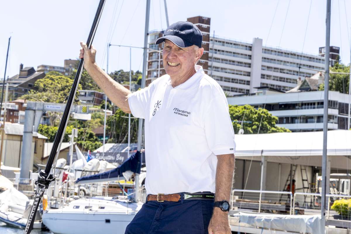
James Frecheville
Want to read more? Subscribe to Cruising Helmsman


