
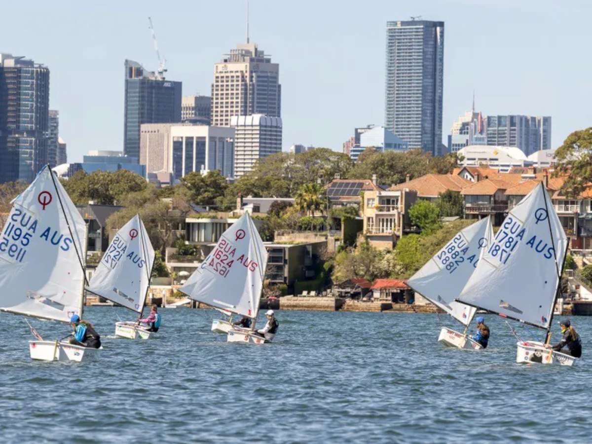
Bundaberg Queensland. East coast of Australia. Bundaberg region population near 100,000.
Lush green. Plenty of rain in the region. Hmmm, must be talking about in other years. It's dry. In Perth on the Australian west coast (other side of the continent), I.E. the other side of the desert. Has a Mediterranean climate. Rains in winter, dry in summer. Owners and tenants in the suburbs hand water their lawns. Not in Bundaberg. They are not used to that. So the lawns are brown and dry. Won't last long. The northern storm season is near.
Meantime the fronts and low pressure weather systems come from the west to the southern portion of south west of Australia. Sweep across the Great Australian Bight bringing rain, wind, gales and storms. In the Bass Strait region this weather can squeeze with other lows and depressions (Bass Strait being between the Island state of Tasmania and the south east of Australia). These cause fronts with gales to sweep northwards along the Australian south east coast.
The Equinox period (September) bring gales, sometimes severe. One must pick. “Be picky” and sail between the weather patterns. It would be stupid not to be picky. (When possible that is).
Bundaberg was a nice experience. (In fact everything has been A1). The Marina and complex immaculate. All the buildings beautifully maintained and painted. – Clean as. The lawns trimmed. (Needs rain). Travel boat lift and its pen with huge gate was neat. Hard standing well ordered.
Gets my tick.
Whilst at sea before arriving Bundaberg. The “Bundaberg Port Marina” manager, sent me an email via the iridium (iridium has little I) saying Richard and Martin (Bundaberg sail makers) were keeping him up to date with my progress.
Said there will be media on my arrival. Guess what? There was. Blimey.
Arranged was lift out. So the yacht could be surveyed. (Time to renew insurance). Ray Pettengell Queensland Marine Surveys did the survey and organised washdown and bottom antifouled. Last done year ago by Matilda Bay Shipwrights at Royal Perth Yacht Club. The bottom was amazingly clean. (Self polishing paint).
The guys on the Travel Lift were terrific. Because it is tidal with current, the have long poles with padded big hooks, to hold the yacht in place. I made one of the guys holding one of these poles laugh. I told him him he “looked like a serial killer”. Anything but.
I would sincerely like to thank Geoff Bayer Marina Manager. Brett Hensley manager of the hard stand area. (I reckon he could manage the Hyatt Hotel. His politeness, smile, management and good order). Get that at the Hyatt and at Royal Perth Yacht Club. One glance at the yard would confirm what I just wrote.
I asked Martin Morison, the Bundaberg “port Canvass and Sail Repairs” what can I do about all these nice people. Martin suggested cutting out sail squares from my used mainsail. (Which had done two circumnavigations). Richard cut them out amongst other things.
As mentioned in my last blog. I stayed with Richard and Maree Stainton and their two dogs. I couldn't go near my bed without the dogs beating me to it jumping on and taking over. Not dumb those dogs.
The first Saturday was the Opening Day of the Bundaberg yachting season. The small country yacht club, as with other country sporting, show the best. All volunteered. Ladies bring all the eats. More than what's eaten. Everything immaculate, tidy.
Richard sails on (usually skippers) the Commodore's Sports Boat. I should meet up with them in Perth February 2018. Coming over for the world championships at South of Perth Yacht Club.
The north wind seemed to be set. Time to sail “Perie Banou 2” to the Gold Coast. (Before the southerly head sea strikes). The Burnett River (Bundaberg) lies due west of the north end of Fraser Island.
Fraser Island (more or less) is 65nm long 6 to 10 wide, sort of (The worlds biggest Sand Island). The sea state inside – between, the island and mainland, is flat (most times). The more south you go the flatter it gets. There are Islands one can anchor behind.
“The Great Sandy Straits”.
Is riddled. Riddled! That's no exaggeration. Riddled with sand banks. Shallow banks. Heaps and heaps with narrow channels. One wouldn't want to be on the turps navigating southwards – or northwards. Getting stuck at high tide would be interesting.
(Interesting to those not stuck, that is).
But it is sand. Probably not damaging to a keeled yacht. About midway the channel is a squeeze with turns. Cannot navigate at low tide. Much too shallow.
In a previous year I anchored with two other vessels near the shallow and waited a couple of hours.
To navigate the Straits I pilot by vision. Using the B&G plotter using the Navionics chart card to check bearing to the next lateral marker. Plenty of those. All the way. The southern end of the Straits is a lengthy creek with skinnier off shoot creek leading to Tin Can Bay Marina. About 6 or 7 n miles.
I made contact with the Marina manager on the VHF radio.
Tide was low. He thought my 2 meter draught would be a little too deep. Told me where I would probably stop. So at trolling speed I did just that. “Stopped”. Short time later a power boat wash had the boat floating again.
The Tin Can Bay Marina manager stayed back, helped me to tie up. Bit awkward with current at low tide. The shallows are very close to the Marina. (They move).
Much thanks to his patience and time.
Tin Can Bay Marina has a super nice restaurant. A small walk is a town popular pub. (But they have no McDonalds). Oh dear me.
Next stop “Gold Coast”. (Dodging southerlies). Leaving Tin Can Bay easy. Just don't run aground. Between south end of Fraser Island and the mainland is the “Wide Bay Bar”. Notorious. Shallow sand and moving banks. Without warning the sea can (well & truly) break.
Tin Can Bay Coast guard SMS to me way points. (3 of them). One must do a zig zag course. (Go from one, to the other, to the other). “Do not” not do that. With a northerly blowing and an ebb tide ( that's going out tide) into the sea causes waves to be steep and close together.
It's good for washing down the yacht from the front (oops bow, sorry) to the stern. Head sea.
The current (tide) does sneaky tricky things. Stirs up sand and makes the section your sailing into look shallow. It ain't. (Shallow-shallow that is). Don't go elsewhere. Bad idea.
The current can also cause a “line of small wavelets close together”, look like cresting.
One might think that this line is shallow. It isn't. Years back a friend from another state, seeing all this disturbance, changed course, headed for darker green and deeper. It wasn't. The yacht went aground. Eventually a breaking wave came out of nowhere. Giving all on board a scare. Got the boat off the Sandy shallow bottom.
With the route plotted into my faithful B&G plotter and a freshening north wind. My mainsail much reefed early. Down wind sail. Midnight wind was 25/30 kts for several hours. Strong wind warning was in place right to the Gold Coast. It was more like 18/20kts. I think nearer the shore the wind quietens.
On route I pass well to seaward of the Sunshine Coast, Mooloolaba (who can say that). Try spelling it after a few turps tomorrow. It's next to Maroochydore (there you go again). Further on is Morton Bay. The way to Brisbane. Not going there. The Bay is guarded by Morton Island. I pass going south.
Morton Island near 21 n miles long. Then Stradbroke Island 21 n miles too. Clear of Stradbroke one can see the Gold Coast. (Surfers Paradise). Building towers, towering into the sky. There is a breakwater that leads thru the beach into the seaway. Continue south 2 1/2 n miles inside the seaway to birth in the welcoming ” South Port Yacht Club”
Regards to all.
Where's McDonalds?
Jon


