
For centuries the Malacca Straits have been one of the most important trading routes in the world. Over the centuries Indian, Arab, Portuguese, Chinese, British and Dutch vessels have all sailed in these waters.
Todeay vessel types have changed, various types of giant ships from just about every nation pass through these straits daily. Whether they are picking up electronic goods, tin, rubber, palm oil, natural gas, crude oil or just passing through, one third of the world’s shipping moves through the straits yearly.
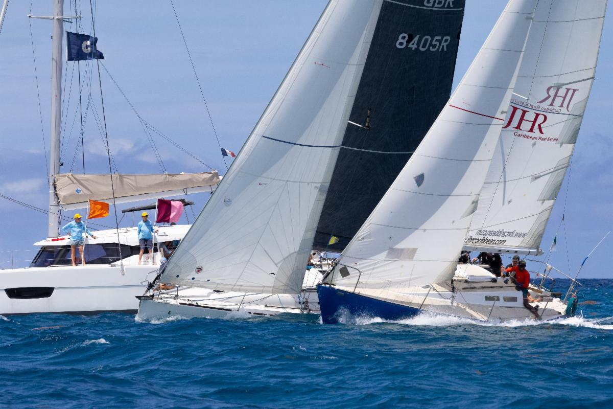
Sumatran sloops and large timber coastal traders also still sail the straits trading with Malaysia, Indonesia, Thailand and beyond. These are large wooden sailing or motor powered ships and are a sight to be seen when they are loaded with cargo and making way through the straits. Then, in amongst the three hundred metre long cargo ships and tankers, is an endless parade of fishing boats of different styles moving in the straits on any given day or night.
Piracy and interstate fighting may have stopped, however the heavy traffic, shoals, currents, the fickle wind and occasional wild weather still makes it a challenging passage for the skippers and crew of the increasing number of privately-owned pleasure boats navigating these straits. Persistent vigilance and a keen look-out are essential for a passage.
For centuries the masters of numerous ships who have neglected these basic principles of seamanship, have come to grief and become yet another statistic added to the increasingly long list of maritime accidents. Many pleasure craft rush through the straits as quickly as possible with Langkawi, Malaysia or Phuket, Thailand being the destinations to the North.
But, if you are willing to slow down there is plenty to see and do both on the land and sea along the way as you travel the strait. Every port appears to have a slightly different culture to enjoy thanks to the diverse cultural influences to the regions over the past centuries. As this has been a trading and shipping route for decades there is history to explore.
Tools we use for traversing
We find the Sail Malaysia Cruising Guide and associated .GPX file loaded up into OpenCPN to be a very good tool.
To make planning your trip easier the GPX file waypoints are cross-referenced to the correct page in the cruising guide. So, if you follow the instructions on the website and have installed both correctly, simply selecting the waypoint link will open the file at the correct page of the guide. See breakout box for web links.
If you are not that tech savvy we have a ‘how-to’ on our blog explaining how to set up layers, companion charts and the cruising guides on your PC.
Companion charts for the cruising guide and Malaysian anchorages (GE2KAP Overlay Charts Malaysia RevXX) can be downloaded from Terry’s site. Also available on Terry’s site are cruising guides for Thailand’s west coast/Phang Nga Bay for those continuing their journey from Malaysia.
Tide information is also important to know, we make use of the Malaysian Government site. Another handy tide site we use is www.tide-forecast.com/
Tide comes in and the water flows this way or that, I wish it was that simple. Normally it does but, unfortunately, the currents in the strait can drive a sailor to drink his weekly allowance in a night trying to fathom the intricacies of which way the water will be flowing in the morning.
There are a lot of waterbodies to influence the currents, so they do not follow the change of tide in the strait. We have found a website that can help shine some light on the subject, it is a great locally produced product. It is a pity, however, that it does not cater to a cruiser’s budget. There is a free info site in the breakout box.
We use several wind prediction and forecasting sites, will they be right on the day? Not all the time, it will all come down to what the local weather is doing, eg. storm fronts. This is still very fluid and can change during the day.
During our trips up and down the strait we found that the GRIB file predictions do not get it right, often due to the local weather influence negating the predicted wind direction. This phone app for keeping an eye on the approaching storms, Rain Alarm, is handy and available at the Google Play app store or iTunes. One nice feature is that it will warn you of an approaching storm, great in monsoon season.
Travel notes: for safety we do most of our travel during daylight hours. There is so much fishing activity and unlit nets, fish attracting devices (FADs) and fishing boats we feel it is better.
If you want to travel by night get out into the shipping lanes as there are few if any nets to dodge. However, you will still need to avoid the ships, tugs and trawlers and, in the wet season, debris washed out from the rivers.
Remember, constant vigilance will be necessary. The ships power through the strait as quickly as they can and it will only take a momentary lapse of concentration to run down your small vessel that disappears from view below its bow.
While an AIS may help you be seen, it is no guarantee. Lots of yachts do travel out in the shipping lanes, or in the barge lanes on the edge of the traffic separation scheme, to stay away from the fishing nets set closer toward the shore.
Travelling by day we could see the flags identifying where the nets were laid. Although it is not always that simple to spot them, we did not have a problem most of the time.
However, that said, there was the odd radical course change to dodge a net when moving into our anchorages.
Fishing craft we came across
Small boats watch out over long nets hidden below the surface.The end of these long nets are usually marked with a float and flag on a bamboo pole.
Most nets are resting on the bottom but there are those who have floating nets and long lines of floats dotting the sea between the lookout vessel and the tail flag.
The tail flags can be of just about any colour and we have seen old shirts and the remains of an old Malaysian flag. If the fisherman is not in attendance there will usually be a matching flag on the other end of the net. There may be flashing lights on the bamboo flag poles at either or both ends, not always easy to see though.
Purse seine boats appear in abundance amongst the others and usually work in a pack. These boats are usually very large and are identified by the large net handling crane on the front deck. Easy to spot and manoeuvre around once you work out where their net is set.
A trawling singular vessel, or a pair trawling, come in various sizes ranging from seven metres to 20m monsters.
The trawlers can be a problem in as much as sometimes it is hard to work out if they are on a singular trawl or are working as a pair with one vessel on either end of the net.
They all usually work tight grids and will travel side by side even when working (trawling) on their own. Set a good look out with binoculars when in busy fishing areas.
How do you know you are in a heavy fishing area? The sheer number of AIS targets is usually the first clue but, unfortunately, not all fishing boats have AIS.
We have come across fishing boats trolling with a long line out the back, these are reasonably easy to work out what they are doing due to the speed and ability to manoeuvre. They still will not get out of your way, so look for the outrigger poles.
Squid boats work at night and are almost impossible to miss due to the number of lights in use to attract the squid to the surface. Be wary if they get up and start to move, I would hardly think they can see a thing past 50 metres due to the amount of ambient light coming from there vessel.
Drift netters, what a pain in the neck these guys are. They are usually at work in areas where the current runs fairly well and have been known to not to look for vessels at anchor before releasing the nets. If they do drop the nets in front of your vessel and become entangled around your boat, go on the offensive straight away.
This is especially true if you are in a charted anchorage, for example Port Kelang. We had a net wrapped around our vessel while anchored in the port anchorage. I went on the offensive straight away without being confrontational.
It all turned out OK in the end, they cut the net and went on their way.
But we have heard of times where the fisherman demands compensation and I believe if you start the dialogue when starting to talk to them with:
‘I am sorry’, then they will demand money. I think a better way is asking them why their net is wrapped around your anchor chain and boat while you are anchored in a designated anchorage.
The trip
The first time we traversed the Malacca Strait we checked into southern end of Malaysia peninsula at Puteri Harbour Marina, they assisted with the check in paper work and run you down to immigration for a small fee.
Once checked in there is a lot you can do here, or you can do nothing at all. However, there are attractions and, while some may not excite the average cruiser ‘Hello Kitty World’ for example, there are other themed attractions a short bus or taxi trip away.
Provisioning from here is also easy with large supermarkets a short distance away. If there is a group of you, the marina may even do a shuttle trip to the mall for you in its mini bus.
The area is being developed at break neck speed and the marina is an entertainment hub. So there will be live shows, jazz festivals and a variety of markets and expos from time to time. There is also several restaurants overlooking the marina and cater for most cuisines and budgets.
Being here puts you in the newly-developed metropolitan area of Johor Bahru, capital of the Malaysian state of Johor. Johor Bahru was formerly known as Tanjung Puteri or Iskandar Puteri. It is the southernmost city in Peninsula Malaysia, a causeway across the Straits of Johor connects it to Singapore.
So the marina can be a great place to base yourself if you want to explore Singapore without the expense of checking your vessel into Singapore. But before taking off over the causeway you may find several attractions to interest you in Johor Bahru.
We spent several enjoyable and at times exhausting days exploring the city and its history. All good things must come to an end and, after an enjoyable stay, we left Puteri Harbour first thing in the morning on an outgoing tide. We delayed our departure to coincide with the falling tide as the tidal flow can be strong in the Straits of Johor.
Our first taste of the shipping traffic we were about to encounter in the strait was as we approached the Malaysian port Tanjung Pelepas near the mouth of the Straits of Johor. We received a call from port control telling us to maintain a radio watch with them and then they gave us the time table of ships coming and going for the next two hours. At one point we were in a self-imposed holding pattern near the port entrance as two vessels left and one entered.
Once we cleared the point of Tanjung Piai National Park we were clear of most of the shipping traffic that was using the container port. However, we were not in the clear by any means, sand barges and dredges were working frantically in the area, all were involved in another land reclamation project. We were a little disappointed because we had wanted to stop off here for a photo opportunity.
This point was the furthest point south of the Euro/Asian continent and the Malaysian peninsula. Anchoring safely here was not an option due to the partly built barrier walls and small craft traffic. While this may not have been a problem, the lack of up to date charts was. Change in the area is going ahead so fast it will more than likely take a couple of years for the dust to settle and the latest surveys and chart updates published. Even Google Earth was a year or two behind on the new coastline.
We continued on to our anchorage for the night, Pulau Pisang, English translation: Banana Island. This is a little island eight nautical miles west of the town of Pontian Kecil on the Malaysian west coast.
Pulau Pisang is the site of the Pulau Pisang Lighthouse. The lighthouse is an important aid to navigation, guiding ships into the western entrance of the busy Singapore Strait. Singapore currently operates the lighthouse and, while Singapore has publicly announced recognition that the island is Malaysian, some in Malaysia fear Singapore will eventually try and claim ownership.
We had travelled just short of forty nautical miles that day and anchored in twelve metres, in a gutter, at 01° 27.9438N 103° 16.2054E. From our anchorage we watched the assortment of shipping traffic moving up the strait.
We have stayed at Pulau Pisang several times now, however on the third stop we got hit by a Sumatra storm, usually short intense storms coming in from the south west. We manoeuvred the boat around into the lee of the island during the start of the storm and were able to get a reasonable but broken night sleep, the boat was not going anywhere due to protection of the island and the good holding.
Where too from here? North and into the strait proper.
The first time we traversed the strait after overnighting at Pulau Pisang we headed up to Pulau Besar, we anchor between Pulau Besar and the mainland. This island is located about seven nautical miles south east of the town of Melaka.
Care needs to be taken as there is a run of low hanging powerlines on poles out from the mainland to the island. The anchorages, north or south of the powerlines, are good and have been used for decades. The old sailing ships would wait in the protection of the island here before moving up to Melaka port for loading and unloading.
This time we were not interested in covering vast distances in one hop every day. So, instead of the long day run after leaving Pulau Pisang, we headed up to Sungai Batu Pahat, Sungai translates to river.
The township of Batu Pahat is located upstream about five nautical miles from the river mouth. Our only obstacle was a shallow river entrance that required us to wait for high tide. Once in over the shallow bar, the river deepens up and navigation is reasonably straight forward. See breakout box with the waypoints.
Batu Pahat has a rough translation of chisel rock and, from what we were told, it earned this name a few centuries ago. There are multiple theories as to the origin of this name.
One theory is that around 1456, the Siamese army led by Admiral Awi Di Chu attacked the Malacca dynasty. Then, in retreat after the battle, they camped in Batu Pahat.
The army chiselled the rocks along the sea and was able to dig a well to survive. Due to the chiselling of rock, the town was then known as Batu Pahat: the name of chisel rock.
It is believed the rock used to build the fort in Melaka was chiselled from here, which would make sense given the location. Judging by the ongoing earth works not much has changed and there is still lots of chiselling, just they are machine powered.
Waiting barges are brought into the river and are loaded with enormous amounts of rock before being towed over the shallow entrance at high tide and onto their destination either north or south.
We had a very quiet night in the river, picking up the anchor in the morning took a little longer than expected. While waiting for the tide we had a storm pass and, when it was time to go, we had snagged a log on the anchor. With a helping hand from a passing fisherman we dropped the log off the anchor and we were on our way.
Our next stop was Muar, a lovely tidy town built on the Sungai Muar. Muar town is also known as the ‘Empress Town’ or Maharani Bandar a name given by the late Sultan Sir Abu Bakar.
Muar is an interesting place to visit and has some magnificent old buildings with features from its rich British and Chinese past. It has a large Chinese population. Due to the shallow river entrance not a lot of yachts visit, which is
a great shame.
There are several great restaurants, hawker centres and traditional markets. We love to shop at the markets and walked away with some lovely fresh produce and an enormous loaf of delicious bread.
Muar is a clearance port with ferries coming in from Indonesia daily. Transport in and out of town is straight forward with buses running north or south from the central bus terminal regularly.
Spending several days relaxing and exploring the town was easy. We checked into Malaysia here.
We had resigned ourselves to the fact checking in could take a while and, like checking in anywhere, show respect, smile and be patient; they have a job to do so let them do it their way. In the end it all went OK. We were checked in and had a port clearance certificate in hand when we left with smiles all round.
Before heading off we went to the Giant supermarket, one of the two large supermarkets in town for some food supplies and stocked up the drinks cabinet with bottles of Australian wines at reasonable prices.
As a word of warning about navigation hazards between Batu Pahat and Muar. During the trip up from Batu Pahat, we had noticed a lot of fishing stakes and FADs in the water shallower than ten metres. The beacons and depths marked on Navionics and C-Map are wrong, nothing new really.
All the beacons are easy to see and marked the correct channel, we watched the fishing boats travelling in and out without any problems. Like Batu Pahat, we were confident about getting in as another cruising couple in a keelboat had visited last month.
First run in we had a set of waypoints gathered from a cruising guide. These waypoints were a long way out and I wonder if the author had WG84 datum selected in his GPS receiver. Second go, after a nail-biting trip in where the least depth under the keel was three hundred millimetres for a short distance, we dropped the anchor opposite the town water police jetty with three metres under the keel. See breakout box for waypoints.
There is a good anchorage point at 02° 02.952N, 102° 33.333E near an old breakwater wall on the southern side of the river. You can go ashore near a ramp and tie up your dinghy, then it is a 500 metre walk to town on a good footpath through well-kept parks.
Whatever you do, do not try and use the nice looking floating pontoon toward the centre of town, this is the Sultans and you may be shot for the privilege of trespassing.
The town anchorage 02° 02.866N, 102° 33.852E is near the Marine Polis base and subject to strong currents in wet season with debris floating down the river, which can foul your anchor chain.
We left Muar on the high tide and had a trouble-free run up to Pulau Upeh a little island just to the north of Melaka. The island is the site of an old resort, we were able to get a nice place to anchor out of the swell near the old jetty and had a quiet night.
At present it is pretty crazy out the front of Melaka. The shoreline is changing yet again with another enormous land reclamation project.
From our estimations the old five metre contour is now two to three metres above the tide line. Everywhere you look is a sand dredging barge, tug, work boat, or large ship. Pulau Upeh appears to have a lot more protection now due to the additional build-up of land around the channel so, if you do not want to brave the marina, it is a good place to stop.
We did not leave in the dark due to several unlit anchor buoys used by the dredges. Once it was daylight and we could see any marker floats or fishing nets, we headed to Port Dickson.
We did not stop in the marina at the entrance to the river, but know several boats have stayed recently. The only thing to keep in mind with this marina is the wall is not solid but has open slots that can let in storm surge.
If you do take up a berth, tie off in an east-west orientation, bow to the west. This way, if a Sumatra storm rolls in, you should be bow-to. If you tie up to the other fingers, make sure you will not knock spreaders with the neighbours if the weather comes up. Where ever you tie up, inspect the cleats are secure and they are sufficient in size.
On the way, we went past the enormous hotel built out over the water just south of Cape Rachado Lighthouse. Strangely enough the lighthouse is located on Cape Rachado, also known as Tanjung Tuan in Malay. The lighthouse is believed to be the oldest in the country, its history allegedly dating back to Portuguese rule of Malacca during the 16th century.
While I say we were headed to Port Dickson we were, in reality, headed to Admiral Marina just south of the town of Port Dickson: www.admiralmarina.com.my/
This is a friendly marina and has good security, nice facilities, which include a swimming pool and restaurants. Need other services? Then take a short walk up the road from the marina to the main road turn right and after a walk through
the park there are a variety of services.
These include a fuel station, small supermarkets, restaurants catering to local breakfasts, lunches or dinners, laundries, hardware, bait and tackle and electrical goods shops. These services are all within walking distance; if, however, you do not want to walk backwards and forwards, rental cars are available from the marina and we know of several cruisers who have taken advantage of the affordable rates.
With our boat tied up securely in the marina and after attending to several maintenance jobs we visited Melaka. Melaka was one of the original Straits Settlements, but the waters eventually proved too shallow for the new larger steamships and Singapore took over its role as the trading hub of the area.
The City is a UNESCO World Heritage Site, which made it a must-see for Malaysia.
Again there has been a melting pot of ethnicities creating a diverse range of unique traditions. The Indonesians, Chinese, Indian, Portuguese, Dutch and the British have left a behind a collective legacy.
The delicious and at times spicy, Baba-Nyonya cuisine came from the mix of local Malay and Peranakan, the Straits Chinese who are descendants of the early Chinese immigration to the region. We certainly enjoyed the differing cuisines, and meal times would see us at different cafes or restaurants sampling the wonderful variety of local fare.
We found the Grab app on the phone most helpful and got a ride to Melaka from the marina for almost half the cost of a taxi. While we had been in Melaka before, we were able to slow down and explore at a more leisurely pace.
Melaka is geared to tourists and it is easy to get around, maps and guides explaining the local attractions are freely available. As an example here is an outline of one of our days: out of the hotel room early and off to breakfast of roti canai washed down with a Teh Tarik, frothy milky tea, at our favourite Indian restaurant.
After breakfast we went for a tour of the river in a tour boat where high tide is better to avoid the smell. Then, after the tour, it was time to take the ride up the tower to get a view of the town and surrounding area. Very interesting and a great way to get a handle on what is going on out the front with the land reclamation project.
After that we headed to Sid’s Pub, a nice little place on the side of the river. After devouring our ploughman’s lunch and a couple of cool drinks it was time to look over the free Customs House Museum.
In the afternoon we strolled through the ruins of the old fort and found Sid’s again, dinner, cold beer and cricket on the tellie, a great way to relax after a hectic day.
After dinner we then hired a trishaw to take us back to our hotel room for a much needed rest before heading out again the next day for more exploring and sightseeing. We went with a plan to spend three days in Melaka and returned seven days later.
The good thing we found was that there is a lot of hotels competing for your business, prices are very competitive and fitted in to our cruising budget. But now the holiday was over and it was time to hit the strait, next stop Port Kalang.
To break up the travel distance we checked out of the marina at midday and moved four miles to anchor behind Pulau Arang Arang:
02° 31.0101N 101° 47.8697E just outside the main town of Port Dickson.
Unfortunately, there is not many places to land the tender where we were confident it will be safe, so we stayed on the vessel watching the passing parade of people and cars on the foreshore. After a comfortable night we hauled the anchor as the sun was peeking over the horizon.
Unfortunately the currents and wind were not working with us and we were only just nearing the Port Klang entrance as the sun was setting. We were partly disabled due to a failing stern tube shaft bearing and could not use full engine power. So we sailed, tacking into a strong head current.
After an exciting few hours (yes hours) of negotiating the entrance, anchored ships and the crazy traffic coming and going we made it safely to our anchorage for the evening at Selat Che Mat Zin South: 02° 55.3978N, 101° 15.7413E. There are a lot of anchorages described in the Sail Malaysia Cruising Guide and we picked this one because it was close to the entrance.
In the morning we wanted to head to the top of the port so we could make a quicker exit the next day. The change of tide had come and gone and we waited as the current continued to push south strongly through the port. Then, just over two hours after the tide had changed and we could
see the water level was lower, the current started to turn, it was time to pull up the pick and head to the anchorage near the top of the port.
We anchored at 03° 03.9400N, 101° 20.0800E and enjoyed a quiet evening. We did not rush off in the morning and waited for the outgoing current. It was hard work under sail but we finally cleared the port and were on our way.
Next stop, the Bernam River (Sungi Bernam), the entrance into the river is quite shallow but we were able to clear it on a half tide without any problems.
We anchored for the evening out front of the Chinese Temple at 03° 50.8197N, 100° 49.2712E. Tuck in close to the bank so the returning fishing fleet has plenty of room, we have heard of one yacht anchoring too far off the bank and was struck by a trawler.
The next day saw us travel forty miles to Pangkor Marina. This is a great marina, there is a good local support from suppliers and trades people. The marina staff will bend over backward to help you.
In 2016 we enjoyed the festivities of the rally stop, then carried on. In 2017 we hauled out here to fix the stern tube propeller shaft bearing, have the shaft straightened and put on the spare prop. Then we went home for December.
While we were away we had the old antifoul scraped and sanded off back to the barrier coat.
On our return we worked to put on new barrier coats, top coat and several layers of antifoul, this took a while so we splashed back in on March first.
Pangkor Marina is a great stop to resupply. Hire a car for a few hours, or a day or for that matter, a month from the marina. Then it is a short drive to five major supermarkets, plus several smaller ones.
If you want a good western style meal head off into Lumut to the Capri Restaurant, here there is either Italian or German fair to choose from. Across the street is Jooks Joint, a restaurant and bar with pool table and, on a Friday, they crank up the barbecue and cook up Australian beef tenderloin and local fish at a great price.
If you are looking for local food there is an enormous number of restaurants to choose from. A couple of our favourite hawker centres are the 555 food court or the Restaurant WDS in Sitiawan; the food is hot and the beer is cold at both places. Getting there is easy and both are listed and visible on google maps for the address.
The island of Pangkor is a five minute ferry ride across from the marina. We passed on the pink taxi-vans for motorbikes to explore the tiny island.
Clear waters lapped at the islands beaches and food stalls line the streets along the island roads. We checked out the ruins of a Dutch fort built in the late 1600s used to control the Perak tin trade and later used as protection against the locals.
At our last stop, we visited the timber boat builders shed, we watched the frame of a boat come to life. Great stuff watching a timber boat coming together from large slabs of timber. If you are in the marina and are running short on money there is no ATM in easy walking distance of the marina. However there are a several on Pangkor Island, so take the short trip on the ferry to get cash, it is cheaper than a taxi or renting a car.
If you do not need to go into a marina but still want to drop in, there is an anchorage out the front of the marina. We have used this a couple of times: 04° 12.6163N, 100° 35.6715E. We then take a tender ride in and tie up at the small boat dock.
There is a pub, several restaurants and convenience shop at the ferry complex. If this is not to your liking due to weather then there is an anchorage up in the Dinding River, Lumut. The anchorage is detailed in the Cruising Gu


